Total Asset Management
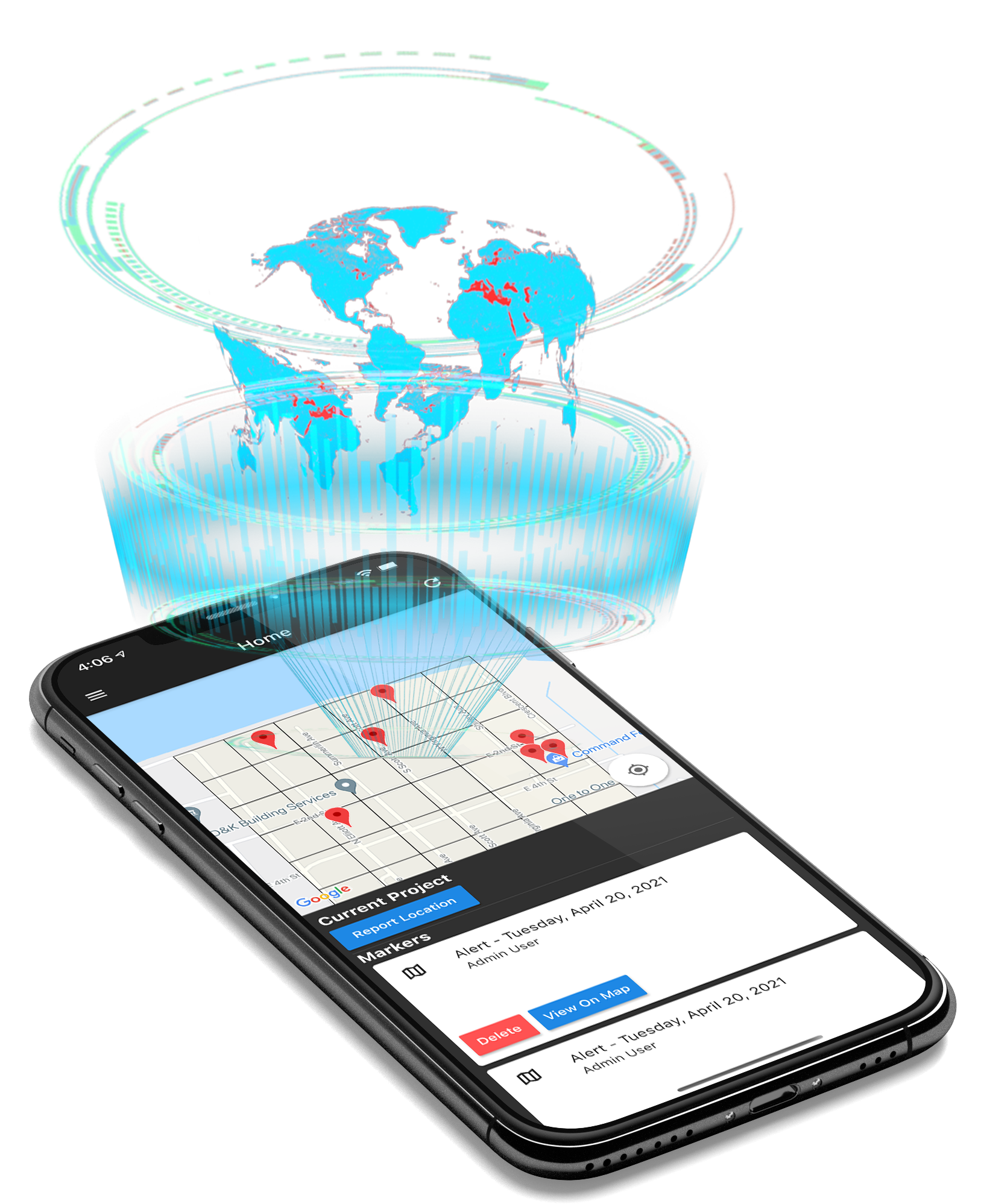
Real-Time Field Data & Team Tracking Services
Managers and Operators that use the Grid Map It platform can deploy their personnel/resources/trucks or any field asset for a faster and more efficiently utilization.
This enables them to focus on a more targeted approach rather than crisscrossing the area in attempts to complete their assigned tasks. Project Managers gain greater real-time data across their field operations and therefore respond with more efficiency based on real-time field input.
Get StartedProject Managers
Standardized for efficiency and effective asset allocation. Accelerate the delivery of an operational plan utilizing grid based field data that provides real-time tracking. Live reporting makes it easy to track issues in the field.
Discover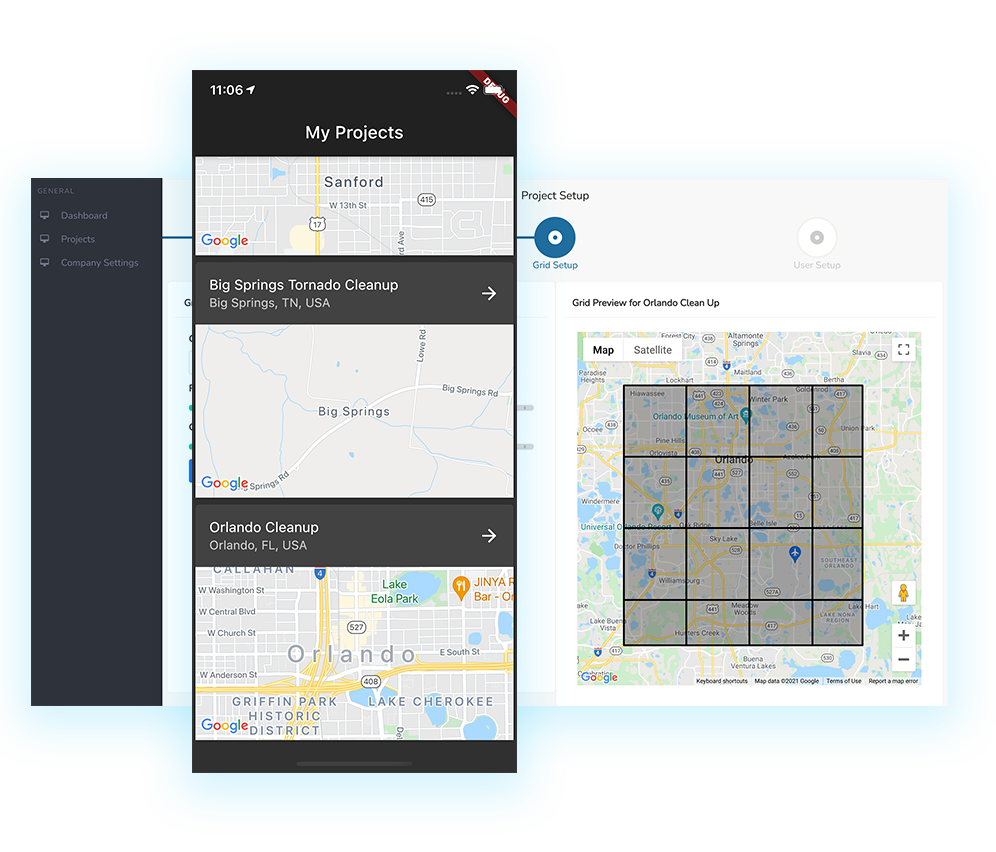
Field Operators
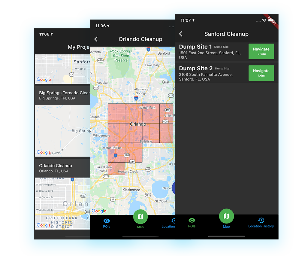
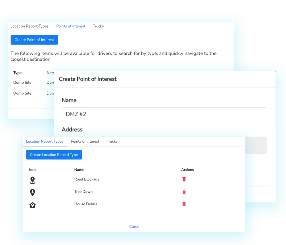
Operators have real time access to POIs and drop off locations within their assigned grid
Field reporting allows your Field Operators to drop pins and make notes on issues they encounter which are reported live to the projects manager dashboard
DiscoverTruck & Operator Assignment
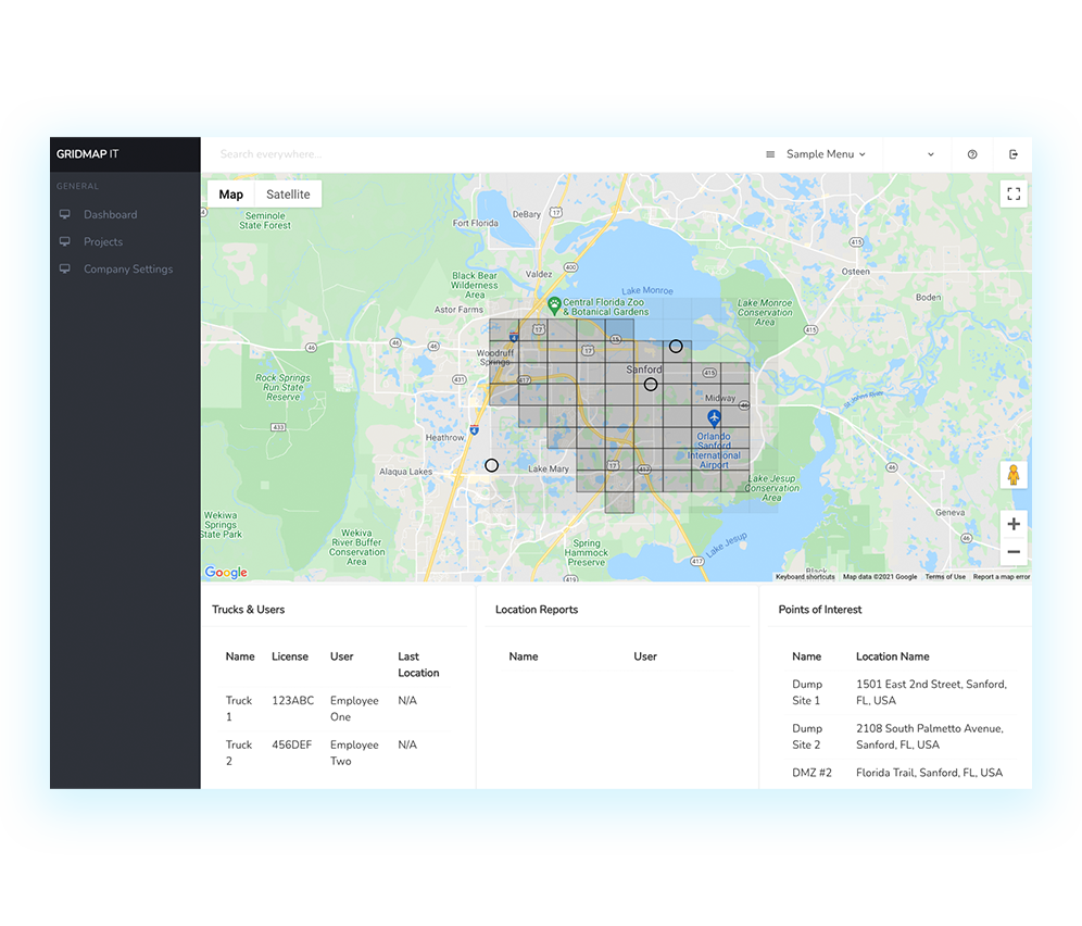
Project managers can easily assign trucks and operators to specific cells within a project grid using our grid management tools.
Discover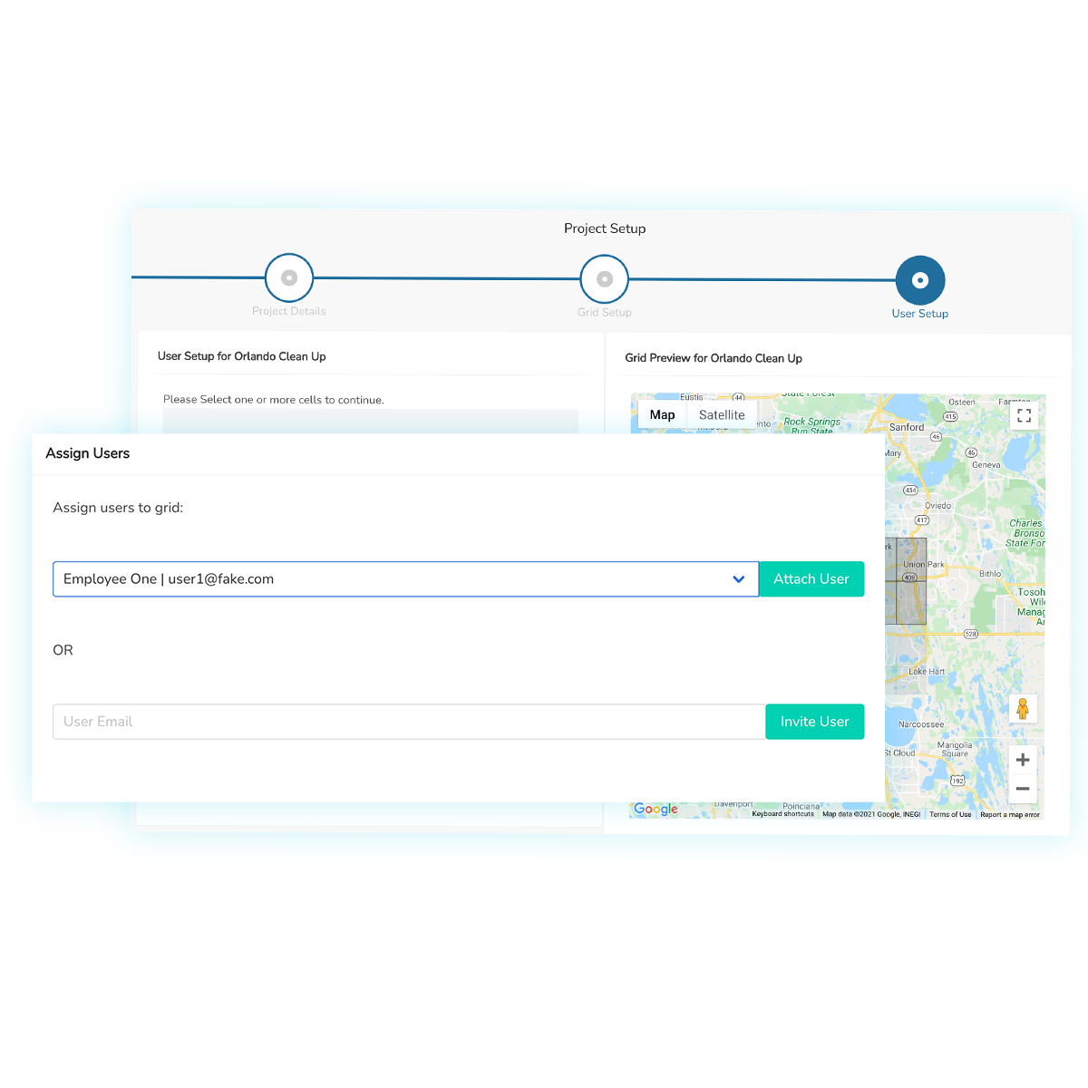

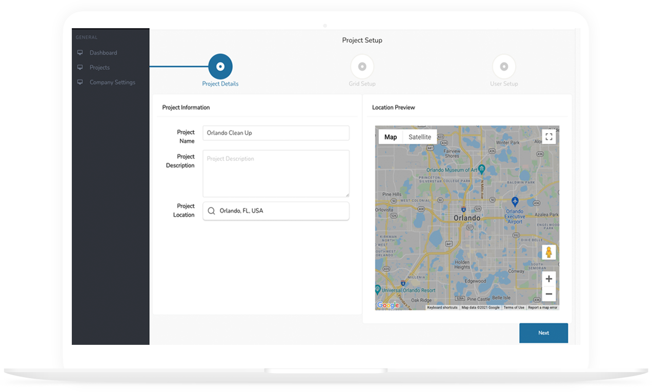
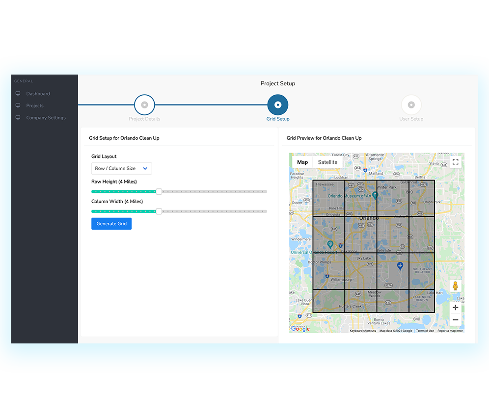
Setup
Easily establish a dynamic grid over the entire project area.

Fleet Tracking
Quickly assign locations to your operators and track your fleet of trucks live

Dashboard
Use our suite of tools to communicate with your Field Operator and manage the project.
Why Use Grid Map It?
Fast
‘Grid Map It’ allows you to draw a grid, assign cells, and get straight to working in no time.
Powerful
From the big picture to minor details, our dashboard gives you the tools you need to manage every aspect of your project.
Efficient
Asset Allocation and Field Operations management, tracking, and in-the-field reporting ensures that you have the right intel for managing, tackling and controlling any job.
Plans and pricing
Our pricing scales with you and your needs. Contact us to for packages and pricing
Request a QuoteFrequently asked questions
How do I get contractors/field operators to join a project?
Is there a limit to how many projects I can have?
How do operator/assets know where to go in a project?
Are there annual contracts I have to sign to join?
Do I need to be a pro with smart devices to work with Grid Map It?
Can Grid Map It work with GIS data?
Get started with Grid Map It
Access our guide and discover everything your
company needs to become compliant.
How it works?
Just 3 simple steps to start using Grid Map It.
Newsletter Signup